


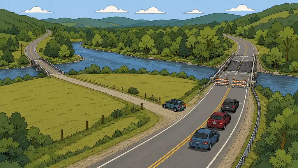
Most route planning stops at “I know the way.” You picked the fastest road, maybe a backup, and you can drive both in your sleep. That’s necessary and nowhere near sufficient — because a route doesn’t fail evenly along its length. It fails at a single point, and if you haven’t found that point in advance, the crowd, a wreck, or a bad decision by someone in charge will find it for you.
The engineer’s way to look at a route is as a chain. Its strength is the strength of the weakest link, not the average. And on almost every route out of almost every area, the weakest links are the same handful of features: bridges, tunnels, underpasses, and the narrow spots where many roads funnel into one. These are chokepoints — the places where the whole flow depends on one thing staying open.
Why bridges own the top of the list
Bridges deserve special attention because they concentrate the most flow through the least redundancy. There’s often no way around a river crossing for miles, which means one closed bridge doesn’t slow a route — it severs it. Trace your routes out from home in every direction and mark every bridge. The Recon tool has major bridges to help get you started.
The other reason to care about chokepoints is that they’re where the threats concentrate too:
- Crowds pool there. In an evacuation, thousands of vehicles hit the same crossing and it becomes a parking lot. You don’t want your plan routed through the exact point where everyone else’s plan also runs.
- They’re targets. Chokepoints are points of weakness in the system, which makes them the most likely place for a failure — or, in a genuinely bad scenario, a deliberate one.
- They carry hazards. Major routes move hazardous materials by truck and rail. A derailment or crash at a pinch point near you is its own emergency — East Palestine, Ohio in 2023 was the wakeup call many preppers still haven’t answered.
Plan your route to its worst link, not its average one. One blocked bridge turns a good route into no route — so the alternate isn’t optional, it’s the point.
The Strategic Highway Network trap
There’s a specific chokepoint most people never think to check: whether your route rides on the Strategic Highway Network (STRAHNET) — the roads designated as critical to national defense. In a major event, expect these to carry military traffic and supplies, which makes them both a likely target and likely to be secured and closed to normal travel. Again, you can see these within the Recon tool
The lesson is counterintuitive: the biggest, best road may be the least usable one when it matters. Build your route plan assuming the primary defense corridors could be unavailable, and have surface-street alternates that don’t depend on them.
Do the work: trace, then branch
This is straightforward homework, and Area Recon is built for it:
- Trace your primary route from home in each direction you might need to travel — to work, to your bug-out location, to family.
- Mark every chokepoint on it — bridges, tunnels, underpasses, funnels. Each mark is a point that can sever the route.
- Draw an alternate that avoids each one. If a chokepoint has no bypass, that’s the most important thing to learn now, not at the closed bridge.
- Note what’s near the chokepoints — rail lines, pipelines, hazmat routes — so a plan that runs past one accounts for what could go wrong there.
Do it once, on the map, while it’s calm. The payoff is that when a route fails, you’re not discovering the problem — you’re executing the branch you already drew.
Bottom Line
- A route is a chain — plan to its weakest link. Bridges, tunnels, underpasses, and funnels are where routes sever, not slow.
- Bridges first. No redundancy, high crowd pooling, and prime targets. Map every one on your routes.
- Distrust the biggest roads in a crisis. STRAHNET corridors may be secured, targeted, or closed — keep alternates that don’t need them.
- Trace and branch in advance. Every chokepoint gets a mapped bypass now, so a closure triggers a plan instead of a scramble.
Open Area Recon, trace your routes home, and flag every bridge and pinch point — then draw the alternate around each one before you need it.