


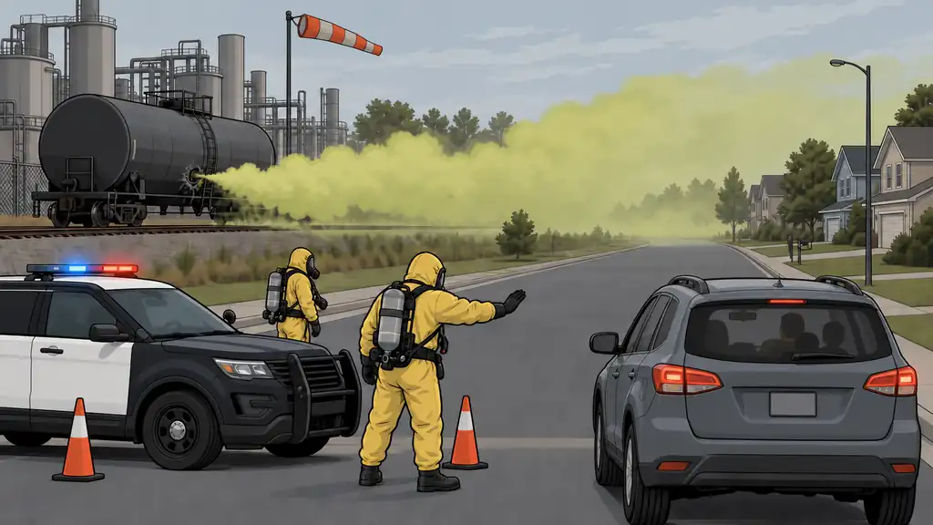
Most threats you prepare for scale with the season or the economy. This one scales with a map. A hazardous-materials release is almost entirely about how close you are to the source — a chemical plant, a refinery, a water-treatment site, a rail line, a pipeline, or a highway that carries tanker traffic. If you don’t live near any of those, this is a genuinely minor threat for you. If you do, it’s a near-neighbor with low odds in any given year but a sharp bite when it comes.
On a 1-to-9 scale it’s 3 for likelihood and 7 for impact. The low likelihood is because most people simply don’t live in the exposure zone. The high impact is what a release does to the people who do: a fast decision between leaving and sealing up, with a real breathing hazard for anyone downwind and unprepared. What makes this threat unusual is how cleanly it splits people. Two counties over, a family will never notice the same event that pushes the family beside the rail yard out of their home in ten minutes. So the first move is figuring out which of those two families you are.
That’s not a stockpiling problem; that’s a map problem and a decision problem.
Why it earns a place
Preparedness is triage by likelihood and impact — but it’s also triage by geography. A threat that’s near-zero for the whole country can be a top-five concern for one specific household. Hazmat is the cleanest example there is. Averaged across everyone, the number is small. For the exposed, it’s a plan they need written before the siren goes off.
And the reason it’s dangerous isn’t that the response is complicated. The response is simple. It’s that the decision is fast and one-way. A toxic cloud moves at wind speed. By the time you can see it or smell it, you may already be breathing it, and the call — leave, or seal up — has to be made in minutes, usually off an official message you’ll only act on well if you already thought it through.
What the record shows
These events run in a few patterns:
- Rail derailments that rupture tank cars of flammable or toxic material — the highest-profile category, able to force the evacuation of a whole section of town and to throw off toxic smoke if the material burns.
- Fixed-facility incidents — leaks, fires, or explosions at plants, refineries, and storage sites releasing gases like chlorine, ammonia, or hydrogen sulfide.
- Pipeline failures and highway tanker crashes dumping fuel or industrial chemicals into a local area.
Two rail cases show the whole range. In East Palestine, Ohio, in February 2023, a Norfolk Southern derailment forced a one-mile evacuation of about 2,000 people and a controlled burn of five vinyl-chloride tank cars — costly and disruptive, but with no immediate deaths. In Graniteville, South Carolina, in January 2005, a derailment ruptured a tank car and released roughly 60 tons of chlorine into a sleeping town. Nine people died, more than 250 were treated, and about 5,400 were evacuated for days. Same category of event. The difference in the death toll came down to the chemical, the time of day, and how fast people either got out or sealed up.
The consistent lesson: the people who came through best either left early in the right direction or sealed up well and stayed put. The ones who fared worst usually did neither cleanly — often because they didn’t know which one was called for, or they never got the alert. The response is binary and the window is short. Hesitation is the failure mode.
How likely — and for whom
Low on average, concentrated by where you live. Your own exposure comes down to a few things:
- How close you are to fixed hazards — plants, refineries, water and wastewater treatment (which store bulk chlorine), fertilizer and ag-chemical storage.
- How close you are to transport corridors — Class I rail lines, hazardous-liquid and gas pipelines, and interstates with heavy tanker traffic.
- Which way the wind usually blows. The cloud travels downwind, so your direction from the hazard matters as much as your distance. A home a mile away but reliably upwind is in a completely different spot than one downwind.
- How fast your area detects a release and gets the word out.
The useful version: pull up a map, mark the fixed sites and corridors within a few miles, note the prevailing wind, and you’ve basically computed your risk. This is one of the few threats you can size up almost entirely from a chair. We’ve created a tool called Area Recon that maps hazardous sites and prevailing winds to help you with exactly this kind of hazard (and much more).
What actually happens — the cascade
- The release. A rupture, leak, or fire puts a gas, vapor, or toxic smoke into the air. Flammable material adds blast and fire; toxic material adds the breathing hazard; a fire involving either throws off dangerous combustion products.
- The drift. The cloud travels and thins out downwind. Danger drops with distance and time, but it can stay hazardous for miles in the early minutes. Wind speed and direction, terrain, and weather all shape the footprint — and a temperature inversion can trap a cloud low and concentrated instead of letting it lift and thin.
- The decision. Authorities decide, based on the chemical and the conditions, whether the safer move is evacuation (get people out of the footprint) or shelter-in-place (keep them inside a sealed room while the cloud passes). Fast, short clouds often favor sheltering; long or growing releases favor leaving.
- The exposure and aftermath. For anyone downwind and unprepared: burning eyes and coughing up to serious injury, depending on the chemical and how much you breathe. Afterward: possible contamination, a delayed return home, and cleanup.
What preparedness looks like
The toolkit is genuinely two skills plus two habits. Build both skills, because you don’t get to pick which one the day calls for.
First: size up your exposure — once. Map the fixed sites and transport corridors within a few miles of home, work, and your kids’ schools. Note the prevailing wind. That one step tells you whether to invest lightly or seriously, and it tells you which downwind escape directions actually work.
Skill one: sealing a room.
- Pick an interior room ahead of time, ideally one with few windows and above ground level. Many hazardous gases are heavier than air and pool low, so a basement can be the wrong choice for exactly the chemicals you’re most likely to face.
- On the order: get everyone and the pets inside, close and lock every window and door, and shut off everything that pulls in or moves outside air — central heat and AC, window units, bathroom and kitchen exhaust fans, the fireplace damper.
- Seal it: cover the gaps around the door, windows, and any vents with plastic sheeting and duct tape; a wet towel at the base of the door helps. Keep a small kit staged — plastic, tape, scissors — so you’re not hunting for it while the clock runs.
- Keep a battery radio or a charged phone in there to hear the all-clear, plus water. Sheltering is temporary. You’re waiting out a passing cloud, then opening up and leaving once it’s cleared.
Skill two: moving crosswind.
- Keep a go-bag ready: water, medications, key documents, a phone charger, a change of clothes.
- Know at least two ways out of your area, and the one rule that overrides your GPS here: move crosswind or upwind — never downwind. Running the same way the cloud is drifting keeps you inside it. Crosswind gets you out of its path fastest; then head upwind.
- Pick a family meeting point and a way to reach each other if you’re separated when it happens.
Habit: alerts. Sign up for your county or city emergency alert system and turn on Wireless Emergency Alerts on your phone. The official message is what tells you evacuate-vs-shelter — and it only helps if you’re enrolled and you’ll actually notice it.
Bottom Line
- Hazmat is a location threat — low likelihood (3/9) for the country, high impact (7/9) for the households actually near a plant, rail line, pipeline, or tanker route.
- Size up your exposure once from a map: fixed sites and corridors within a few miles, plus the prevailing wind. That single step tells you how much to invest.
- The cloud moves at wind speed and the response is a binary, minutes-long decision — leave or seal — so the plan has to be built ahead of time, not improvised.
- Learn both skills: sealing a room (interior, above ground, air handling off, plastic-and-tape) and moving crosswind (go-bag ready, never downwind).
- Sign up for local alerts — the official message tells you which action to take, and it’s useless if you never get it.
This is the rare threat you can size up from a chair and a map. If a rail line or a plant sits within a few miles of your door, spend the twenty minutes now — because the event itself won’t give you twenty minutes.
Map the plants, rail lines, and corridors around your address with Area Recon, and keep your shelter-and-evacuate plan and go-bag list in the Digital Binder.