


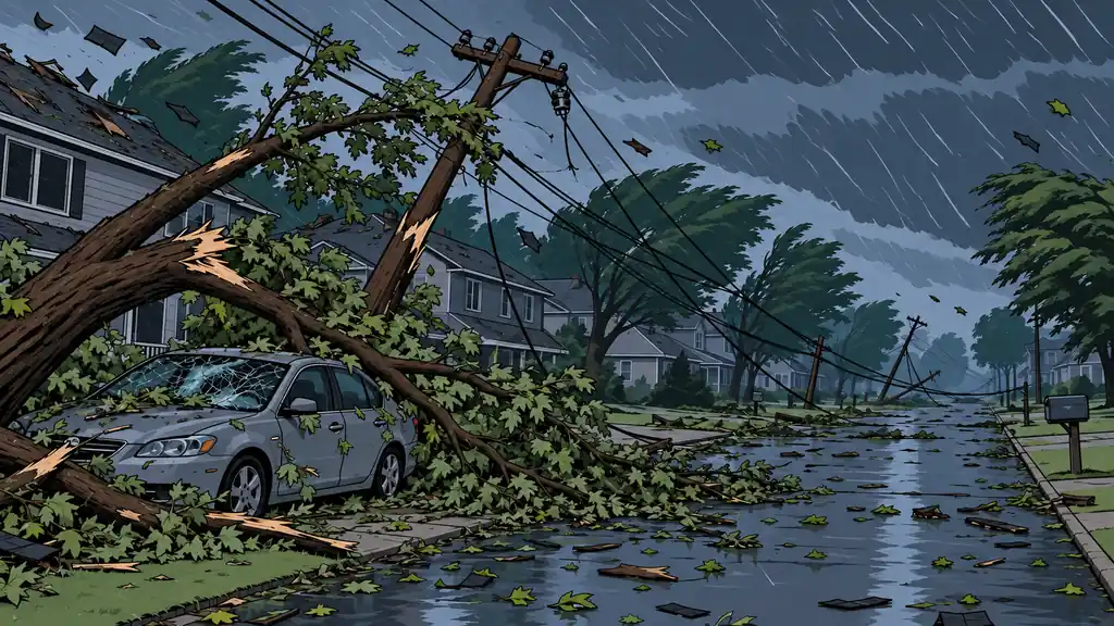
Preppers love the rare, dramatic threats and quietly ignore the boring ones that actually show up. Severe thunderstorms — and their worst form, the derecho — are the perfect example. They rate a likelihood of 6 out of 9 — solidly Possible — because damaging thunderstorm wind is a near-yearly event across most of the country. The impact is a moderate 5: rarely a mass-casualty event, usually survivable if you’re indoors, but reliably able to drop the power across a wide area for days. A moderate hit you’ll take over and over beats a catastrophe you’ll almost certainly never see. This is the threat you actually cash in on.
The framing that matters: a severe thunderstorm is really two events stacked. There’s the wind — an hour or less of real danger. And there’s the outage — the multi-day mess that follows once the damage is spread across a whole region. Most people prepare, if at all, only for the first. The second is where the real work lives.
What makes a derecho different
A derecho is a big, long-lived windstorm thrown off by a fast-moving band of thunderstorms. The engine is the downburst: cold, heavy air drops out of the storm and slams into the ground, then blasts outward as straight-line wind. String enough of those downbursts along a squall line, keep it going over a long track, and you’ve got a derecho.
The difference from a tornado is worth burning into memory:
- A tornado spins. It’s narrow, short-lived at any one spot, and lays catastrophic damage down a thin path.
- A derecho doesn’t spin. It’s broad and long-track — serious damage across a wide corridor that can cross several states in a single day.
To even count as a derecho under NOAA’s Storm Prediction Center rules, a windstorm has to lay down a damage swath at least 250 miles (about 400 km) long, with gusts of at least 58 mph along most of it and several separate gusts of 75 mph or more. So the peak winds can rival a strong tornado — but instead of hitting one town, it hits a hundred. That’s exactly why it takes the grid down over such a huge area and keeps it down.
It’s happened, and the lesson is always the same
You don’t need invented numbers here. The June 29, 2012 “super derecho” ran roughly 800 miles from Iowa to the Mid-Atlantic, killed about 22 people, and cut power to more than 4 million customers in a late-June heat wave. The August 10, 2020 Midwest derecho hit eastern Iowa with gusts near 140 mph, flattened millions of acres of corn, and at about $11 billion stands as the costliest thunderstorm in US history. The lesson repeats every time: the damage is broad and tree-driven, the outages run long because crews are working a whole region instead of one spot, and the aftermath — heat with no air conditioning, food gone bad — hurts more people than the storm did.
The odds: this is a when, not an if
Rated 6/9, and it earns it. Unlike most threats on the list, for most of the country this isn’t a question of if — it’s when. Severe thunderstorm warnings are among the most frequently issued warnings there are. Full derechos are less common than an ordinary severe storm but nowhere near rare; most wind-prone regions get them periodically. Plan on a multi-year horizon and you should simply count on facing damaging thunderstorm winds and the outage behind them. That reliability is what makes prep here pay off — you’ll use it.
I learned this truly is a when threat earlier this year. We got hit by a small version of this threat this past spring. I lost a couple trees, and more importantly, my greenhouse - completely destroyed by the wind and hail that accompanied it. I’ve always loved thunderstorms, but realized that day how destructive this threat can really be.
Do the math: one hour of storm, a week of outage
Here’s the part people get backwards. Put the clock on it:
- The storm is over in an hour. Sometimes less. The wind you were bracing for is gone by dinner.
- The outage runs days — often three or four, sometimes a week if the damage is widespread, because crews face a whole region of downed trees they clear one at a time.
So size your prep to the week, not the hour. Water is the clearest example: four people at two gallons a day is eight gallons a day — for a five-day outage that’s ~40 gallons before you replenish a drop, and more if you’re on a well, because no power means no pump. That’s not a wall of store bottles; it’s a couple of proper containers filled before the season. The freezer is the same kind of math: a full freezer holds cold far longer than an empty one, so a chest freezer packed tight buys you a day or two of frozen food that a half-empty one loses.
The common mistakes
- Prepping for the scary hour and nothing else. The hour rarely hurts an indoor person. The week is what tests you.
- Treating a severe thunderstorm warning as less than a tornado warning. Straight-line winds arrive fast and hit just as hard over a much bigger area.
- Waiting for the warning to fill water and charge devices. You may lose the grid with little further notice. Do it when it’s in the forecast.
- Running a generator wrong. The post-storm outage is exactly when carbon-monoxide mistakes get made — generator in the garage, generator by an open window. That’s how the outage kills you after the wind didn’t.
What preparing looks like
Build it in the two phases the threat actually comes in.
Phase 1 — surviving the wind (minutes).
- Treat a severe thunderstorm warning like a tornado warning. Interior room, lowest floor, away from windows. The habit costs nothing and covers both.
- Do a pre-storm yard sweep. With damaging wind forecast, bring in or tie down patio furniture, grills, trash cans, trampolines, umbrellas. Anything the wind can throw is a broken window or an injury waiting to happen.
- Move the vehicles away from big trees and out from under limbs if you can.
- Top off the charge on phones, battery banks, laptops, and medical devices when storms are in the forecast.
Phase 2 — living through the outage (days). This is the real prep.
- Water: a few days minimum on hand — more if you’re on a well. Store it before the season, not during the warning.
- Food: several days of no-cook or low-cook food, plus a plan to protect the fridge and freezer — keep the doors shut, pack the freezer full, stage coolers and ice for the perishables you want to save.
- Light and information: flashlights and headlamps with fresh batteries staged where you’ll find them in the dark, and a battery or hand-crank NOAA weather radio so you’re not leaning on a phone you can’t recharge.
- Cooling: for a summer storm, have a heat plan — battery fans, knowing the coolest part of the house, hydration, and somewhere to go if it gets dangerous.
- Backup power, sized to need: if you run a generator, know your critical loads — fridge, medical devices, a fan or heater — and run it outdoors, well away from the house, every time.
Bottom Line
- This is a solidly Possible threat — likelihood 6/9. You will face damaging thunderstorm winds; plan on it instead of hoping around it.
- A derecho is straight-line, broad, and long-track — a tornado’s winds spread over a hundred towns, which is why the outage is so wide and so long.
- The storm is one hour; the outage is the event. Size your prep to several days without power, not to the scary hour.
- Two-phase readiness: tornado-warning discipline plus a yard sweep for the wind, then water, food, light, cooling, and backup power for the aftermath.
- Run backup power safely. The post-storm outage is a leading setting for carbon-monoxide poisoning — generators outdoors, always.
Nobody brags about surviving a thunderstorm. But the household that planned for four days without power — while the neighborhood sat in the dark and the heat — is the one that actually understood the threat.
Model the days-without-power side deliberately: the Food & Water Storage tool sizes your reserves in days, and if you lean on a generator, the Generator calculator helps you match it to your real critical loads.