


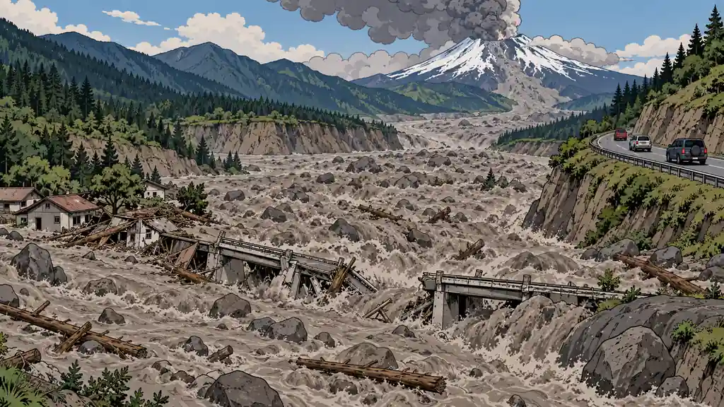
Volcanic eruption is the clearest case in the whole catalog of a threat your address decides. Its likelihood rating is low because for almost everybody it’s basically zero — but that one national number hides two very different realities. For the country at large, near-zero. For a household sitting in one of a few well-mapped corridors, genuinely serious. If you prep in the West, Alaska, or Hawaii near an active volcano, treat this the way a Gulf Coast family treats hurricanes: not an exotic long shot, but a real, recurring hazard with a known drill. If you don’t, spend your prep budget elsewhere and don’t let the drama of the topic pull your priorities out of line.
Note, this threat will focus on the direct impact of being near a volcano. Ashfall is a much more general threat that affects a very different subset of the population and has much different impact. As a result, it’s split out into a separate threat. You can find the volcanic ashfall threat here.
Why it’s on the list at all
The impact rating is high for a reason: for the genuinely exposed, an eruption is devastating — lahars, pyroclastic flows, and ash that collapses roofs, fouls water, and forces long evacuations. High impact times a locally-real chance is exactly the combination that earns a plan. The catalog carries it not because it’s common, but because the people it does reach usually don’t realize how close they live to it — and because the mountain gives warning that only helps the ones who already planned.
Mount St. Helens and the lesson of reach
Mount St. Helens (Washington, 1980) is the reference eruption for American preppers because it showed the three things people get wrong, and it killed 57 people. First, the blast went sideways, not politely straight up — it flattened roughly 230 square miles of forest in minutes. Second, the lahars ran far down the river valleys, reaching the Columbia River nearly 50 miles away.
The recurring lesson everywhere, across all of history, is about timing. The people who knew their zone and left early did fine. The ones who waited to see what would happen were the ones who got caught. Volcanoes almost always tip their hand first — swarms of small quakes, the ground bulging, gas venting — but that warning only turns into survival if the plan already exists.
Think in corridors, not countries
The honest framing is local. For the nation, this is rare. For a household in a mapped hazard zone, the question that matters isn’t the national average — it’s how often your volcano goes and where you sit in its hazard zones. Some are restless on a human timescale; others sleep for centuries and then wake. Either way, your personal odds are something you can look up on a map, not a national number you average yourself into.
Two hazards, two different problems
Treat these as separate, with separate responses, and figure out which one is the boss at your address:
- Lahars (volcanic mudflows). For most valley households near snow-capped volcanoes, this is the number-one killer. Eruption heat melts snow and ice, it mixes with ash and rock into a fast, wet slurry with the consistency of moving concrete, and it follows the river valleys — sometimes reaching towns far from the peak, sometimes with almost no warning. If you’re in a valley downstream of a glaciated volcano, your main plan is fast and uphill: know the high ground and the route to it.
- Pyroclastic flows. Superheated clouds of gas and rock moving faster than you can drive. There’s no gear answer to this one — you survive it by not being in the zone. That’s why knowing your hazard zone beats owning any equipment.
The cascade is regional and long: grounded flights, closed roads, fouled water systems, power and phone outages, and evacuations that can run weeks. Even well outside the blast and mudflow zones, a household can be pinned down by ash alone.
Worked example: are you in the path?
Don’t guess — measure. Take the two numbers St. Helens actually produced. If you live in a river valley within about 50 miles downstream of a snow-capped volcano — the distance its lahars really traveled in 1980 — assume a mudflow can reach you, and your plan is a fast route to high ground. If you’re outside the blast and lahar zones but downwind, assume ash, and size your supplies for it. Same eruption, two completely different plans, and the map tells you which one is yours.
The common mistakes
- Buying gear before reading the map. A closet of masks does nothing if you’re sitting in a lahar path where the only right answer was “leave, now.”
- Planning to shelter from a flow or a lahar. Those aren’t survivable in the zone. The answer is distance decided in advance, not a stronger basement.
- Waiting for certainty to leave. Late evacuation is how people end up in traffic on a road a lahar is about to cross. Pre-decide your trigger and go on it.
- One route out. If your single road crosses the valley that fails first, you don’t have an exit. Have an alternate.
What preparedness looks like: map first, then equip
The order matters. Where you sit drives every other decision.
- Know your evacuation zones and routes cold. Find out which official hazard zone your home is in and which valleys are lahar paths. Learn the fastest route to high ground and out of the region, plus at least one alternate for when the primary is cut. Because the mountain gives warning, decide your leave trigger in advance — and when it trips, leave early instead of waiting for certainty.
- Keep N95 masks and goggles for everyone. Ash is a lung and eye hazard. Stock N95s that actually fit — a loose mask under-protects — and sealing goggles per person, plus spares. Plan for the days-to-weeks ash can persist.
- Store water and seal food. Ash contaminates anything open, including uncovered water and a municipal supply that may already be compromised. Keep sealed water stored and eat and drink from closed containers during a fall.
- Protect engines, filters, and HVAC. Abrasive ash destroys engines and clogs filters. Know how to cover your vehicle’s air intake, carry spare air filters, and be able to shut down or protect the home’s HVAC intake. Your escape vehicle is useless if it eats ash on the way out — which is one more reason to leave before the heavy fall.
Bottom Line
- Volcanic risk splits hard by address: near-zero for the country, serious for households in the Pacific Northwest, Alaska, and Hawaii corridors. Know which you are.
- Eruptions kill with lahars, pyroclastic flows, and ash — not lava. Which one is yours is set by your spot relative to the valleys and the wind.
- If you’re downstream of a glaciated volcano, the lahar is your main threat — plan a fast route to high ground.
- Prep is map-first. Knowing your hazard zone and routes beats any gear, because the deadly hazards can’t be out-equipped.
- Equip for ash — N95s, goggles, sealed water and food, engine and HVAC protection — and pre-decide the trigger to leave early.
Volcano prep isn’t one plan. It’s knowing whether the lahar, the flow, or the ash is coming for your exact address — and having already decided when you leave.
Confirm what actually threatens your location — and map your exits — with the county Threat Report and Area Recon.